2.To start a new project, click "Add Project."
3. In the "Input" section, upload files under the correct heading.
// PLATFORM
02. Processing of data
1. Register to process the required data: 2D, 3D, VR360, update maps for raw data to be entered into the system, and automatically process data
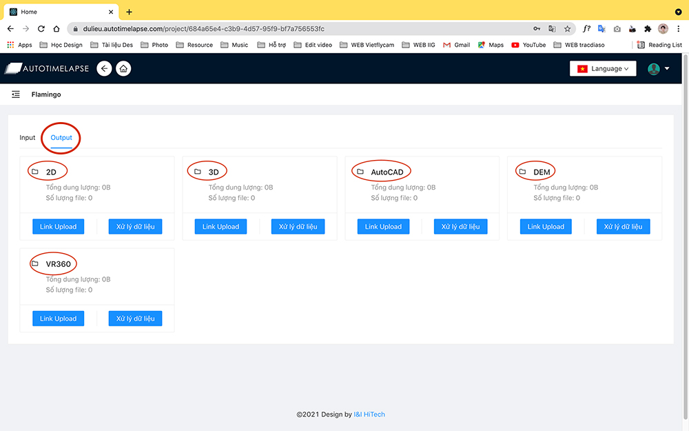
2. Upload the processed data to the "Output" folder.
// PLATFORM
02. Processing of data
1. Register to process the required data: 2D, 3D, VR360, update maps for raw data to be entered into the system, and automatically process data
2. Upload the processed data to the "Output" folder.
// platform
03. Display information
1. Creating two-dimensional and three-dimensional visual maps of the scanned flying area
2. Create scale maps and current status maps to analyze the survey region visually.
3. Measurement and calculation of the complete survey area online using the input data source
4. Compare data from each survey to provide investors a better understanding of the construction process.
Previous
Next
Previous
Next
// platform
03. Display information
1. Creating two-dimensional and three-dimensional visual maps of the scanned flying area
2. Create scale maps and current status maps to analyze the survey region visually.
3. Measurement and calculation of the complete survey area online using the input data source
4. Compare data from each survey to provide investors a better understanding of the construction process.
Geodetic data can be seen online.
Steps to enter data
Access to the output
Upload
2D - TIFF . Photo Upload
3D- Upload LAS . File
Technical drawings (AutoCAD)
VR360
Storage
Online display
Online measurement
Online presentations
Online storage
Basic
100.000 VND / Month
Auto Timelapse is the user interface for the display.
Allows an unlimited number of projects to be uploaded, stored, and edited.
100MB - 10GB data capacity
Online 2D drawings can be seen and measured.
Online 3D models can be seen and measured.
Show Contour, AutoCAD
VR 360 returns to 2D shooting points automatically.
Premium
1.500.000 VND / Month
Auto Timelapse is the user interface for the display.
Allows an unlimited number of projects to be uploaded, stored, and edited.
10GB - 100GB data capacity
Online 2D drawings can be seen and measured.
Online 3D models can be seen and measured.
Show Contour, AutoCAD
VR 360 returns to 2D shooting points automatically.
Business
6.000.000 VND / Month
Professional Timelapse Display Interface
Experimenting with a variety of add-on tools
100GB - 500GB Data capacity
Features of a 2D drawing
- Online map editor
- Show viewer location
- View and measure 2D drawings online
- Make a list of important topics and share the information with others.
Features of a 3D drawing include:
- View and measure a 3D model online.
- Make videos with animated 3D models
Show Contour, AutoCAD
VR 360 returns to 2D shooting points automatically.
Enterprise
10.000.000 VND / Month
Professional Timelapse Display Interface
Experimenting with a variety of add-on tools
500GB-1T Data capacity
Features of a 2D drawing
- Online map editor
- Show viewer location
- View and measure 2D drawings online
- Make a list of important topics and share the information with others.
Features of a 3D drawing include:
- View and measure a 3D model online.
- Make videos with animated 3D models
Show Contour, AutoCAD
VR 360 returns to 2D shooting points automatically.
Geodetic data processing in real time
The system converts raw data such as image centers, drone photos, GCP, PPK points, and other geodetic goods such as 2D geodetic maps, 3D models, and VR360 images into geodetic products such as 2D geodetic maps, 3D models, and VR360 images accurately and fast.
PACKAGE FOR IMAGE PROCESSING
99.000 VND / GB
Transform collected flying photos into 2D and 3D.
2D and 3D flight photos are converted into 2D photographs and 3D models.
Image retouching, enhancement, and cropping
VR360
199.000 VND / Image
Combine many photos into a VR360 experience.
Combine many photos into a VR360 experience.
As needed, edit and trim off missing areas, as well as cut and combine logos.